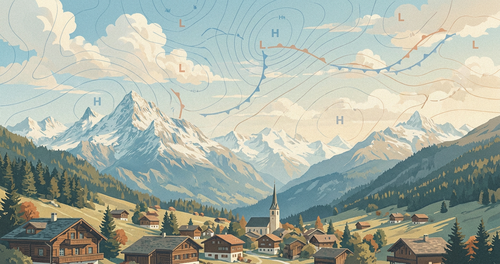
Mountains can put low cloud and precipitation on one slope while a valley on the other side turns warmer, drier and gustier. Stau describes the windward build-up. Föhn, also written foehn, describes the downslope wind in the lee.
The familiar picture of rain on one side and warm, dry air on the other is real, but it is only one contributor. Several airflow processes can combine, and Föhn does not always need windward precipitation.
One Mountain, Several Airflow Paths
The textbook explanation follows moist air up and over a ridge. The air cools, forms cloud, loses some water as rain or snow, then warms as it descends.
Air can also descend from around crest level, mix down through turbulence, or reach a sunny lee slope without producing windward precipitation. Several processes often act together, and their balance changes with the larger weather pattern and the shape of the terrain.
Stau on the Windward Side
Stau is the Alpine term for that windward pile-up. It develops when airflow meets high ground. Some air rises, while stable low-level air may become blocked or turn along the range. As rising air reaches lower pressure, it expands and cools. If it reaches its dew point, water vapour condenses into cloud droplets or ice crystals. Continued ascent may produce rain or snow, but precipitation is not guaranteed.
Cloud and precipitation depend on the moisture supply, wind speed and direction, atmospheric stability and terrain. A moist flow aimed across a long ridge usually produces stronger lift than one running nearly parallel to it. A persistent feed of moist air can prolong the event and raise totals in exposed areas.
Stau can therefore bring anything from a cloud cap on a summit to persistent low cloud and heavy precipitation. Humidity and Dew Point Explained covers saturation, while What Is Precipitation? explains how rain and snow are reported.
What Rising and Sinking Air Does
Unsaturated air cools by roughly 1 °C per 100 metres as it rises. This is the dry adiabatic lapse rate. After cloud forms, condensation releases latent heat, so saturated air generally cools more slowly. Its exact rate varies with temperature and pressure.
Air that crosses the crest and descends encounters increasing pressure. It compresses and warms, cloud droplets may evaporate, and relative humidity falls. If the air also lost water through windward precipitation, it can arrive in the lee warmer and with less water vapour than air at a similar elevation upstream.
This thermodynamic pathway explains many Föhn events. It does not explain all of them.
The Main Föhn Mechanisms
The Met Office describes several mechanisms that can combine in one event.
Condensation and Precipitation
Moist air rises, forms cloud and may lose water as rain or snow. Latent heat released during condensation reduces the cooling during ascent. The air then warms by compression as it descends into the lee. This familiar pathway can add to the lee-side temperature and humidity contrast.
Draw-Down from Aloft
Stable air near the windward surface may be too dense to cross the barrier. Air from around or above crest level passes over instead and descends into the lee. Because it started higher, it can reach a valley warmer and drier than the cool air it displaces, even without windward rain.
Turbulent Mixing
Mountain waves, rotors and wind shear mix the atmosphere vertically. This can transport warmer, drier air downward and gradually erode a pool of cool valley air. Föhn may blow above a valley before gusts and mixing bring it to the surface.
Clear-Sky Warming
Cloud can remain banked against the crest while the lee clears. Sunlight then adds surface warming during the day. It can strengthen the observed contrast, but the cross-mountain airflow and descent remain central to the event.
Dry or anticyclonic Föhn can occur with little cloud and little or no precipitation on the windward side. MeteoSwiss documents this Alpine pattern. Föhn air is often dry, but not moisture-free, and cloud can still occur in the lee.
South Föhn and North Föhn
On many ranges the prevailing wind favours Föhn on one side only. The Alps are a clear exception. MeteoSwiss names Alpine Föhn after the direction from which the flow arrives: southerly Föhn on the north side of the Alps, and northerly Föhn on the south side.
Southerly Föhn
A southerly Föhn develops when air approaches the Alps from the south. Cloud and precipitation often build as Stau on the southern slopes. From the north, a bank of cloud along the ridge is the Föhn wall. Descending air then clears the lee, leaving a Föhn window of brighter, often deep-blue sky in valleys on the north side.
Precipitation on the south side can spill a short distance north of the main ridge. Which northern valleys are wet, and which receive the strongest Föhn, depends on wind direction relative to the passes.
Northerly Föhn
A northerly Föhn develops when air approaches from the north. Stau then sits on the northern slopes, while air descending the southern side warms and often clears. Valleys south of the main ridge can become milder and sunnier even when the north side stays cloudy.
The same reversal occurs on other ranges when the flow changes direction. The wet side and the Föhn side swap.
Why Valleys and Passes Matter
Air does not cross an entire range evenly. Passes, gaps and valleys aligned with the flow guide it through lower terrain. Constrictions and channelling can strengthen the wind, so one valley may have damaging gusts while a neighbouring valley remains calm beneath cool air. Microclimates Explained covers those local contrasts.
The transition can be abrupt. A dense pool of cool air may sit on a valley floor while Föhn blows above it. Gusts and turbulent mixing erode that layer. When the downslope flow reaches the surface, temperature, humidity and wind can change quickly.
Stable air crossing a ridge can also oscillate downstream as mountain waves. Smooth lenticular clouds may mark the waves. In the Alps they are sometimes called Föhn fish. Ragged rotor clouds can indicate strong turbulence below. Neither cloud type proves that Föhn has reached the valley floor.
Stau, Föhn and Rain Shadows
Stau and Föhn describe weather during a particular airflow pattern. A rain shadow is a longer-term climate tendency. It develops where prevailing weather patterns repeatedly favour ascent and enhanced precipitation on one side of a range, with lower average precipitation in parts of the lee.
The lee is not dry in every storm, and the wettest location is not automatically the highest summit. Wind direction, storm tracks, moisture source, elevation, season and the orientation of the range determine where precipitation is enhanced or reduced.
In the United Kingdom, the Met Office notes that notable Föhn events often occur across the Scottish Highlands when moist westerly flow meets high ground on the west coast. The west can stay wet while lower ground to the east is warmer and clearer. That contrast can also appear as a longer-term rain shadow, not only as a single event.
Föhn-type winds have regional names, including Chinook east of the Rocky Mountains, Zonda east of the Andes, Nor’wester east of New Zealand’s Southern Alps, and the Helm wind of the English Pennines. Their behaviour differs with the terrain and larger weather pattern.
Weather and Safety Impacts
Föhn can bring mild, dry and clear conditions to the lee, sometimes with a rapid temperature rise. Strong events can also damage exposed structures and disrupt roads or cable cars. Mountain waves, wind shear and rotors create serious aviation hazards and dangerous conditions on ridges.
Warmer air can soften snow and increase melt. Check the local avalanche service where snow conditions are relevant. When vegetation is already dry, gusty wind and low relative humidity can accelerate fire spread. Föhn does not ignite a fire by itself.
On the windward side, prolonged Stau can bring flooding, landslides, poor visibility or heavy snowfall. Conditions can be hazardous on both sides of the ridge for different reasons. Use an official mountain forecast and local warnings before travelling, and read Wind Speed Explained when judging gusts and exposure.
How to Read a Föhn Setup
Look for airflow across the ridge and a pressure difference between the two sides of the range. How to Read a Synoptic Weather Chart and Atmospheric Pressure Explained cover that larger pattern. Crest-level wind, atmospheric stability, upstream moisture, valley temperature profiles and the expected position of fronts show whether the setup can produce Stau, Föhn or both.
No single measurement proves that Föhn will reach a particular town. A strong cross-mountain pressure difference can exist while cold air remains trapped in a valley. A small change in wind direction can route the strongest flow through another pass.
Useful signs include windward cloud near the crest, a Föhn wall, a clearer Föhn window in the lee, lenticular clouds, falling relative humidity and increasingly gusty valley wind. These clues must be read together. Forecast models can also smooth narrow valleys, steep slopes and rotors that are smaller than the model grid.
Use Airpult for the Larger Pattern
Our location forecasts let you compare current temperature and humidity and hourly precipitation chances at nearby places on opposite sides of a range. The Sion Airport forecast is a useful Alpine-valley example because Föhn can reach the Rhône Valley, while Airpult Explore helps you choose other locations for comparison.
The public forecast does not provide a valley-scale Föhn diagnostic, crest-level wind forecast, mountain-wave turbulence guidance or official warning feed. Do not infer safe conditions on a ridge from a warm, dry reading in the valley. Keep the relevant national or local mountain forecast and warning service alongside Airpult when conditions are sensitive to terrain.